HISTORY
What is Castner Range?
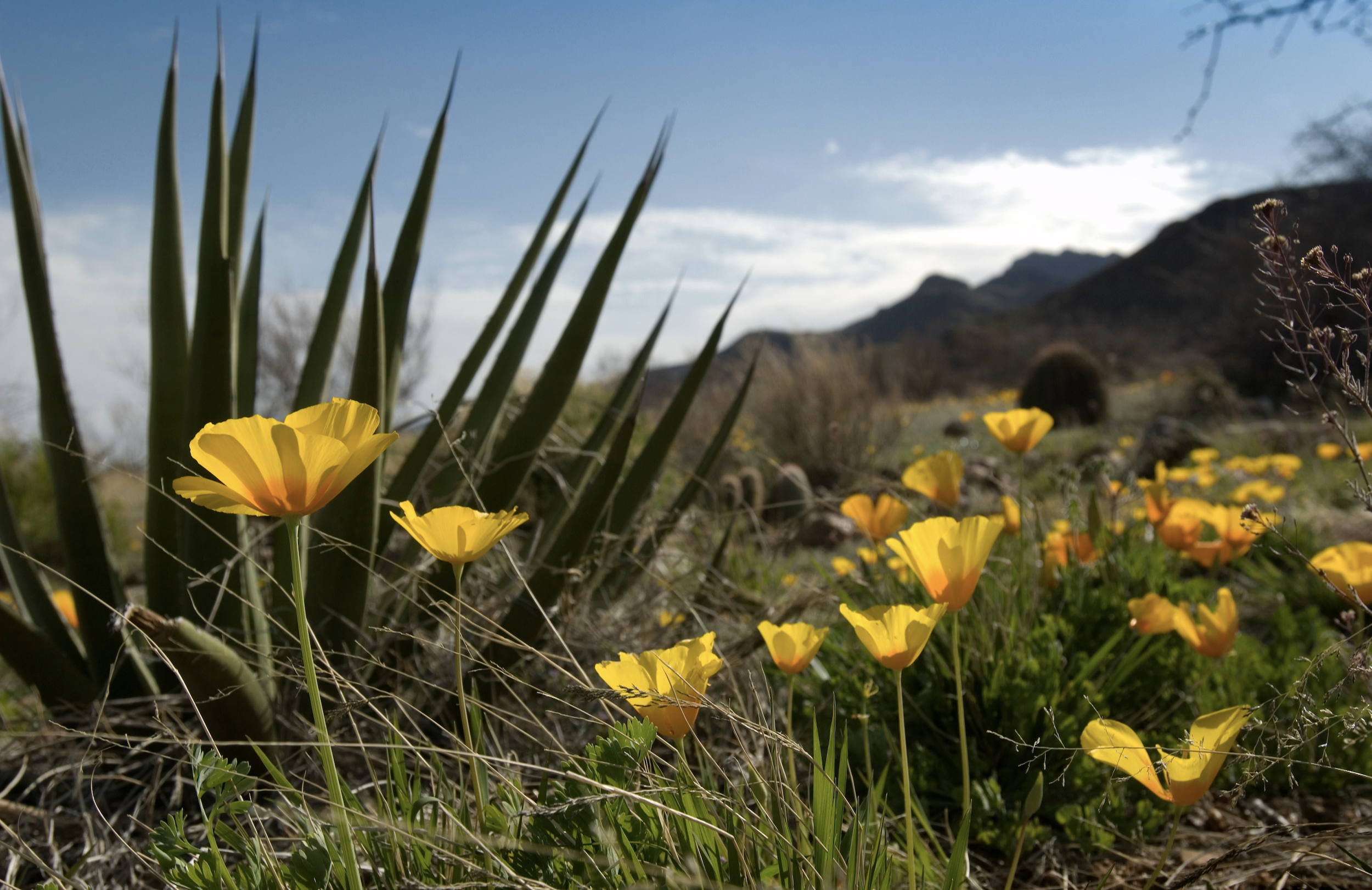
Located in the heart of El Paso (America’s 22nd most-populous city), Castner Range is home to over 6,600 acres of West Texas beauty. A former US Army firing range, the area has been preserved due to the long-standing stewardship of the U.S. Army and Fort Bliss. The area contains the ancient ruins of the region’s first inhabitants, along with bountiful evidence of developing agriculture, old rail systems, mining remains and historical military presence. This land tells the story of El Paso del Norte better than any book could ever do. Castner Range is especially known for the springtime blooms of Mexican Gold Poppies that carpet the rugged desert terrain. For fifty-two years (1971-2023), the people of El Paso had been campaigning to forever protect the land’s cultural, historical, scientific and environmental attributes. On Tuesday, March 21, 2013, President Joe Biden dedicated Castner Range as a national monument.
Why is Castner Range so important?
-
The greatest concentration of springs in the Franklin Mountains are on Castner Range. They are the hidden jewels of these desert mountains, supporting pockets of unexpectedly lush vegetation, and providing invaluable wildlife habitat.
-
Eroded material carried by water from a mountain canyon and deposited at the canyon mouth creates a broad, sloping landform termed an alluvial fan. In the Franklin Mountains, most of the fans have been built on or excluded from the State Park to accommodate future development. Only on Castner Range are good examples of alluvial fans, particularly the one emerging from Fusselman Canyon, still being protected.
-
Castner Range includes some of the most geologically complex, and visually striking, parts of the Franklin Mountains. It is the only place where El Paso can still preserve a beautiful unobstructed view, from freeway to ridge line, of all three mountain zones (steep slopes, foothills, alluvial fan).
-
As our planet continues to be affected by climate change, we will continue to see larger storms worldwide and, specific to the Chihuahuan Desert area, larger flash floods and monsoon rains.
Castner Range acts as a natural collector and distributor for a large part of the flood water that would otherwise flow straight into residential El Paso and the surrounding communities. The natural arroyos and flood paths provided by the land make it possible for the water to be absorbed into the land and replenish the Paso del Norte region’s aquifers with an increasingly scarce desert resource – water.
-
The history of El Paso and the City of Las Cruces and the Mesilla Valley is inextricably connected to a complicated human history of migration, conquest, colonization, and the sharing of culture, language, and natural resources.
This entire region is closely connected to neighboring Cidudad Juarez and its 1.5 million residents. Visitors from Cidudad Juarez and northern Chihuahua frequent El Paso and the Mesilla Valley, visiting places like the Organ Mountains-Desert Peaks (OMDP) National Monument, just across the state line in New Mexico. Castner Range is one of El Paso’s most iconic and intact Chihuahuan Desert landscapes and holds great significance to Frontera residents who, over the last four years, have borne the brunt of xenophobia, mass shootings, a rampaging pandemic, and the militarization of our border. The protection of the Castner Range will ensure that Fronterizos have the opportunity to find solace, comfort, and equitable access to the outdoors, right here in our community.
-
Nearly contiguous with Castner Range, Franklin Mountain State Park and Organ Mountains-Desert Peaks National Monument (5 miles away) are conserved areas that provide sanctuary to the native flora and fauna of the Chihuahuan Desert.
Together, they form a distinct mountain chain that is home to several endemic species and that forms an important wildlife corridor for species such as mule deer, mountain lion, javelina, and more resources. Twenty-seven wildlife or plant species listed as “threatened or endangered” by the U.S. Fish and Wildlife Service may be present on the Range, including the ferruginous hawk, the Texas horned lizard, the Franklin Mountains talus snail and the desert night-blooming cereus.
Preserving Castner Range would create a safe passage for these animals and allow several vulnerable and endangered species to reestablish their populations.
-
Structurally, the Franklin Mountains are a north-south trending fault block that has been tilted westward. Thus, it is on the east side that we see the early geologic history of our region most fully exposed. In the Castner Range foothills, you can find the oldest rocks in the El Paso area. They are part of the Castner Formation, deposited as alternating layers of lime and clay mud in a shallow sea 1.3 billion years ago.
-
The lower elevations of Castner Range on either side of Trans Mountain Road support a unique floral assemblage that is an important Texas resource. Unique soils and a far west Texas location combine to make this the only known location in Texas for several plants. The most outstanding member of this floral assemblage is the showy Mexican Gold Poppy, found in Texas mainly on the lower slopes of Castner Range.
-
Castner Range is dotted with archeological sites, including the Fusselman Canyon Petroglyph Site and the White Rock Shelter.
-
For many military families, especially those with links to the time when Castner Range was an active training site, the land and its poppy fields are an important memorial to those who have served our country. Fort Bliss, of which Castner Range is a part, holds a unique place in African American military history since it was home to several regiments of all-black Army units known as Buffalo Soldiers, the first peacetime all-black regiments in the regular U.S. Army. In the years after World War II, tens of thousands of African-American soldiers served at Fort Bliss, with many of them choosing to make El Paso their home after retirement. Currently, almost 20% of soldiers and families stationed at Fort Bliss are African American. While Castner Range was acquired and used by the Army after the Buffalo soldiers were stationed at Ft. Bliss, Castner Range’s designation provides an opportunity to tell the unique contributions that African Americans, and all Fort Bliss military have made and continue to make through their service at Ft. Bliss.